Terravect Systems
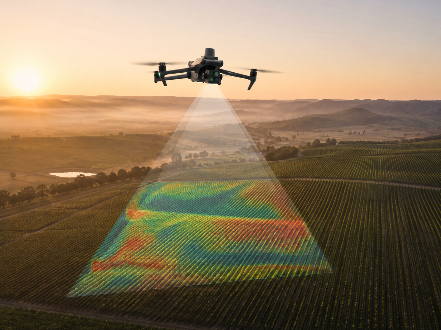
Overseer drone surveying a managed surface at dawn, projecting a multispectral scan footprint
Terravect Systems

Fleet Command

Investor briefing

The command software that orchestrates an autonomous aerial-ground fleet. Detect turf disease, stress and fire before they cost you — across golf courses, training grounds and estates. Subscribe to the platform; lease the drones with it only if you need them.

A Terravect Systems venture · Software-first. Precision-engineered, built to last.

Confidential. This briefing and everything in it is the confidential and proprietary information of Industrial Assets, trading as Terravect Systems, shared with you in confidence for the sole purpose of evaluating an investment. By viewing it you accept responsibility for keeping its contents confidential, and agree not to disclose, reproduce or distribute any part of it to any third party without our prior written consent.
The problem

Golf courses and pitches go blind between inspections.

  • Turf disease, drought stress and pest damage are found days too late — by eye and on foot, across more surface area than any team can walk in a day. A large golf course spans 50–80 ha; a training complex covers dozens of pitches. The blind spots are enormous.
  • Blanket treatment wastes chemistry and time. Turf managers need to know exactly where to act — but the ground truth changes faster than weekly inspections can track.
  • Precision hardware is a capital purchase most clubs won't make — and even where drones exist, there's no brain coordinating them. Kit without orchestration is just expensive gadgets.
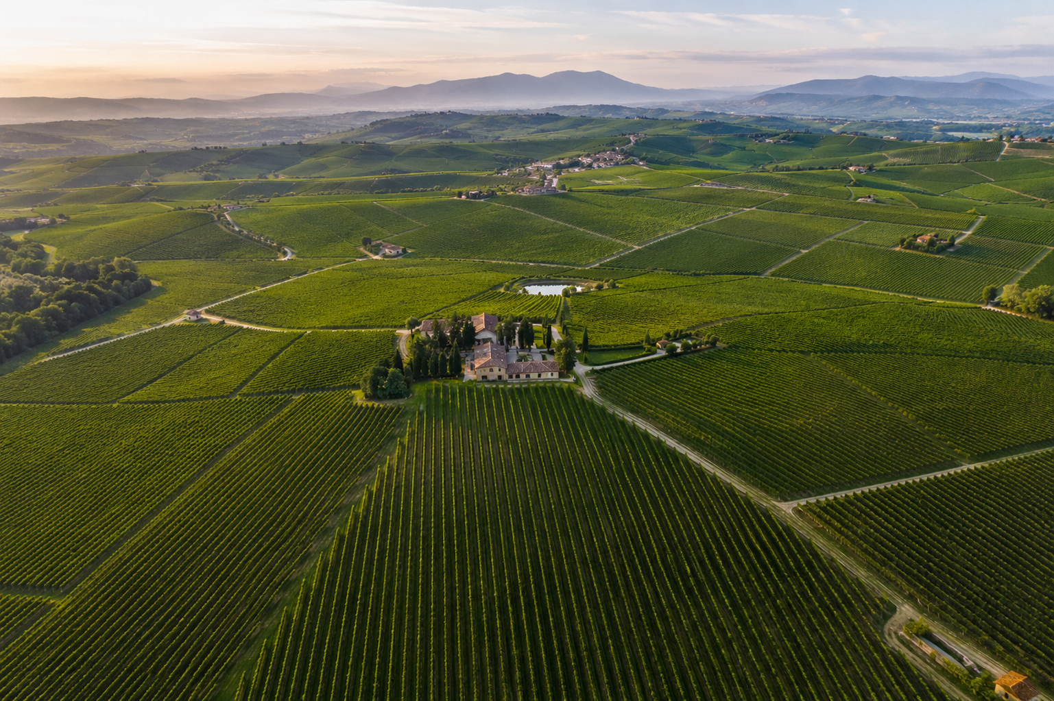
Wide turf landscape viewed from above
The solution

Fleet Command is the brain. It orchestrates the drones.

The product is software — a command platform that turns aerial drones and ground rovers into one coordinated operation. The air senses and diagnoses; the ground acts on what it finds; Fleet Command decides, dispatches and pre-empts across the whole fleet in real time.

You subscribe to the platform. It runs compatible drones you already own — or, if you'd rather not buy hardware, we lease it to you with the software, so the whole system stays an operating cost, never a capital outlay.

The same engine serves golf & sports turf first, then vineyards and other crops, then industrial estates — any managed surface that benefits from continuous aerial observation.
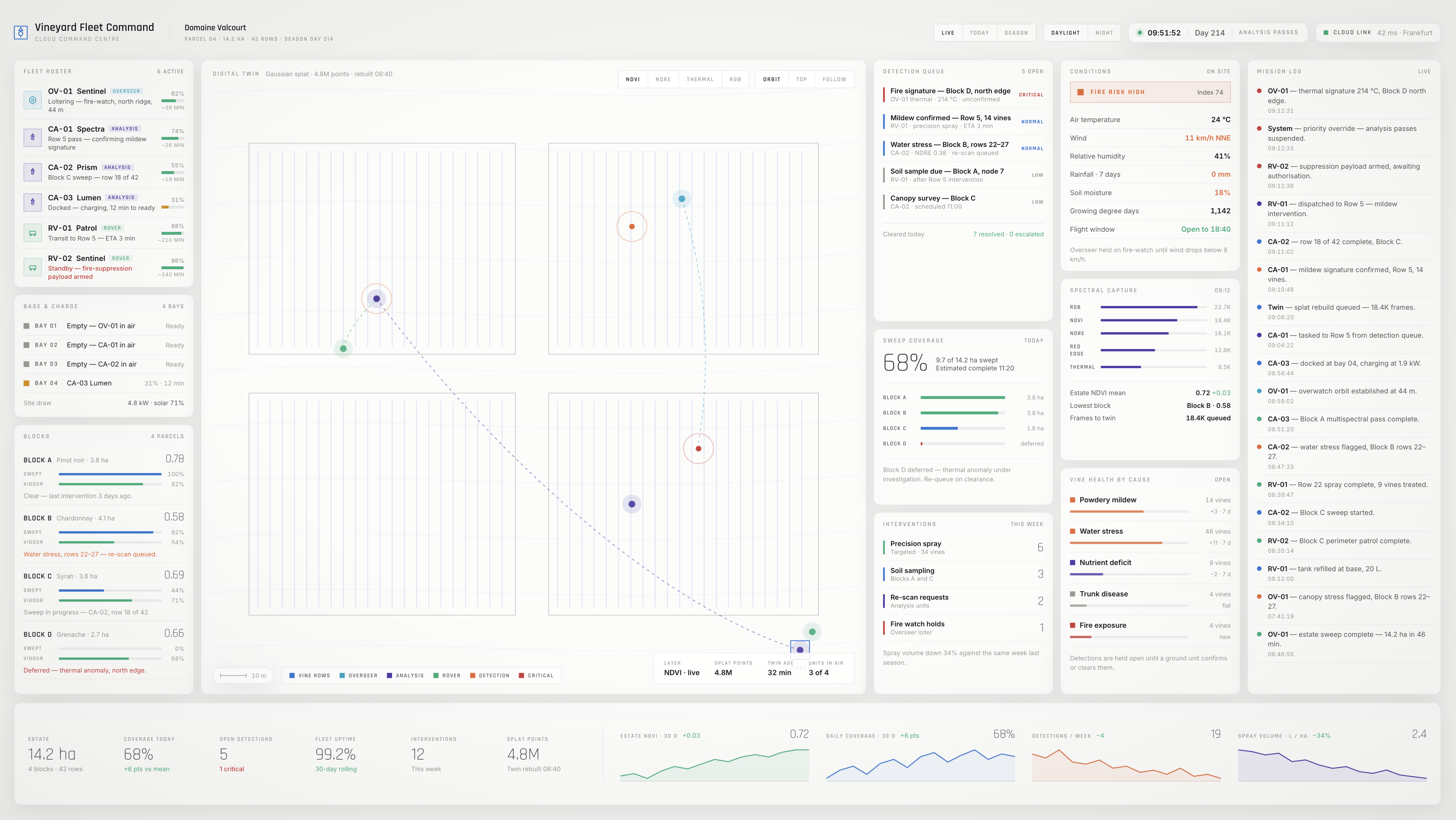
The Fleet Command software console — fleet status, mission log, live digital twin and alerts
Fleet Command — the operator console. One platform across turf, crops and estates.
How it works

The units Fleet Command drives — off-the-shelf where it can be.

Overseer hexacopter at altitude

Overseer

Aerial · situational awareness

A fast hexacopter that sweeps the estate at altitude — mapping rows, flagging anomalies for closer inspection, and standing continuous fire-watch.
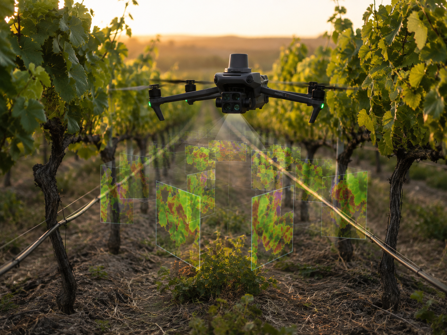
Analysis drone scanning a surface with multispectral sensors

Analysis Drones

Aerial · detailed imaging

Low, slow quadcopters that scan lane-by-lane with a multispectral array — confirming detections and capturing the imagery behind the digital twin of the surface.
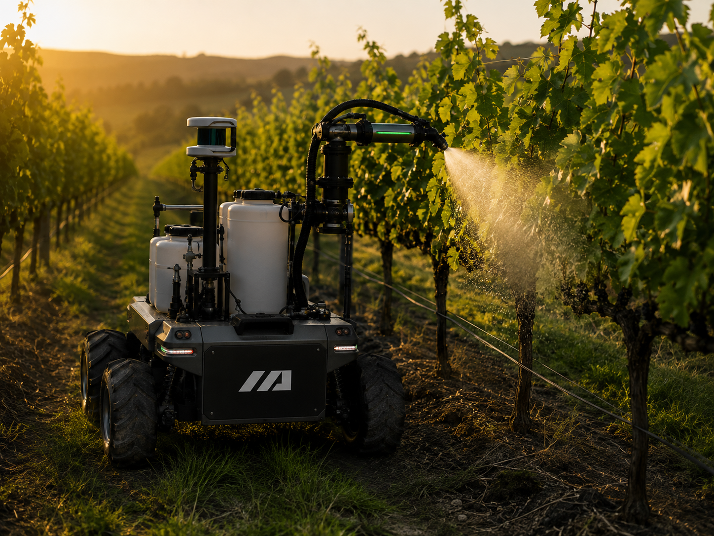
Six-wheel ground rover on a managed surface

Ground Rovers

Ground · physical response

Six-wheel rovers with swappable payloads — precision treatment, soil sampling, fire suppression — dispatched to the exact GPS coordinates of a detection.

The loop Fleet Command runs: the air detects → the software dispatches the right rover → the ground responds. A critical event — fire — pre-empts everything else automatically. Aerial units build on proven airframes like the DJI Mavic 3M, customised and folded into the lease; the orchestration on top is ours.

The demo

The software is already running — and it isn't a video.

Behind the "Begin simulation" button, the real Fleet Command console drives a live digital twin through a scripted morning: the overseer sweeps at dawn, analysts scan the surface lane-by-lane, detections escalate into ground missions, and a fire triggers a priority override — in real time.

The same build is our development harness, our investor demo, and the sandbox where a prospect watches the platform run on a model of their own site before committing. One artefact, three jobs. Four real venues are modelled today — two golf and football EAP prospects, two vineyard demo clients.
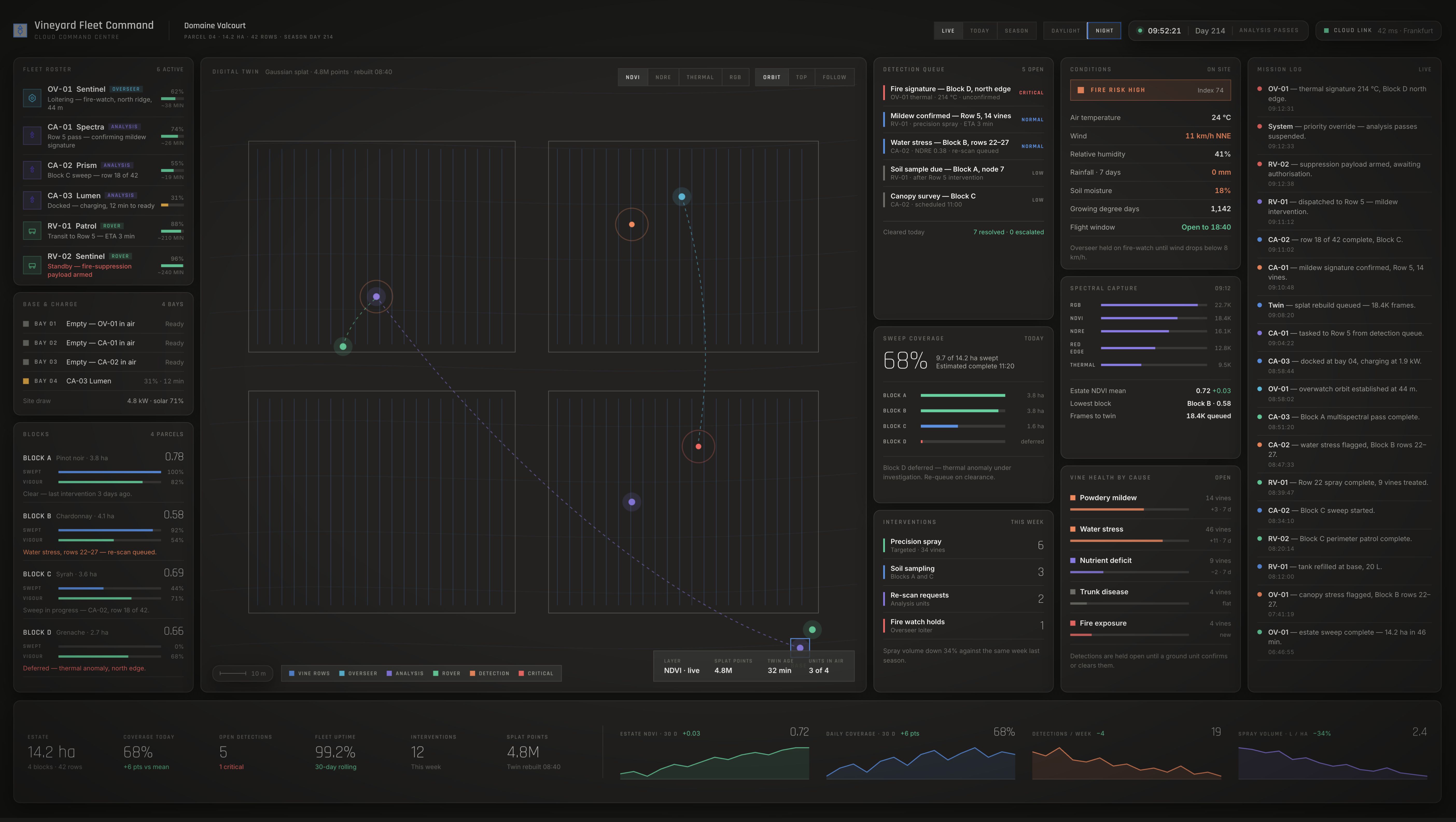
The Fleet Command console in field mode, coordinating the fleet during a live scenario
Field mode — the same console, running the fleet in real time.
What it does

Six jobs, one fleet.

Surface health

NDVI/NDRE maps turf stress, disease and drought before it's visible to the eye.

Pest detection

Damage signatures classified by ML; confirmed before any treatment decision.

Precision treatment

Rovers treat only the affected zone — a fraction of the chemistry, exactly where it's needed.

Soil sampling

Georeferenced cores build a spatial soil-health model over time.

Fire detection

Thermal watch, priority override, first-response suppression.

Digital twin

Point-cloud reconstruction of the surface — a queryable 3D record no walk-through can produce.
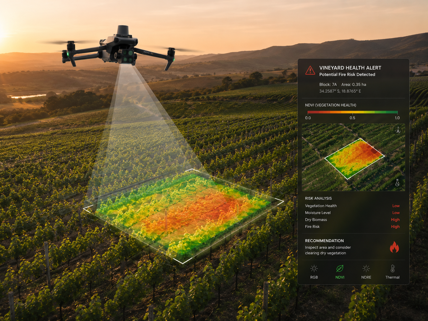
Fleet Command console flagging an alert over a managed surface
Priority override — the same RGB / NDVI / NDRE / Thermal readout you see live in the simulator.
Data & the digital twin

Every flight trains the fleet — and rebuilds the surface in 3D.

The system doesn't just act on today's conditions; it compounds. What the fleet sees today makes it sharper tomorrow, and turns each site into a photoreal model its manager can explore.
  • A compounding data asset: every multispectral, RGB and thermal frame — paired with the outcome a rover confirms on the ground — becomes labelled training data. Detection and diagnosis models improve with every scan lane, site and season, so accuracy climbs and false alarms fall.
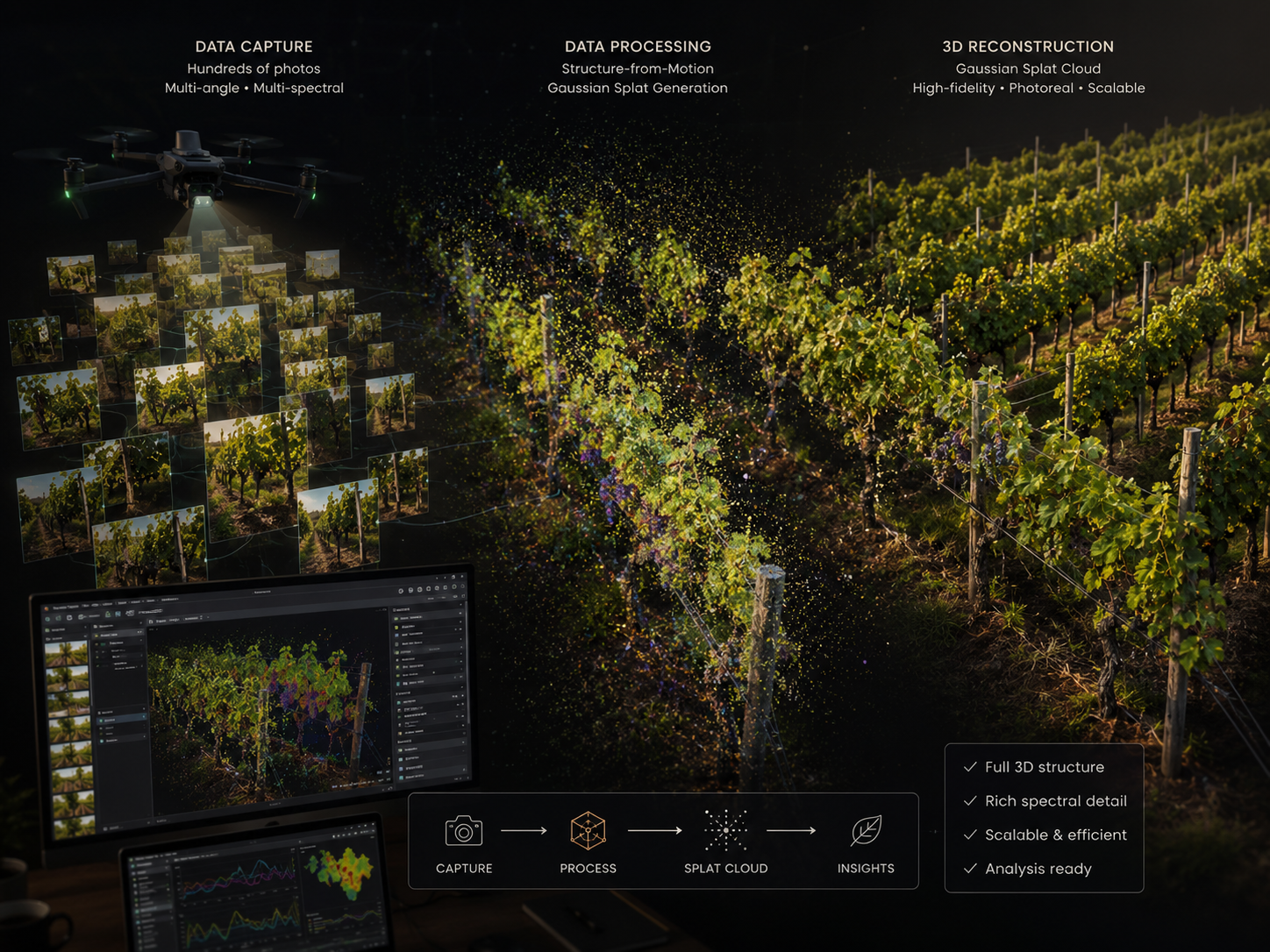
  • Point-cloud surface visualisation: the low, slow analysis drones capture the imagery behind a Gaussian-splat reconstruction — a photoreal, queryable 3D twin of the surface, at sub-metre resolution.
  • A living record: revisit any zone at any date, measure surface-health trends, and watch change over time — something no walk-through can produce, and no competitor can retro-capture.
Drone imagery reconstructed into a Gaussian-splat 3D point cloud
Survey imagery → Gaussian-splat point cloud → a queryable digital twin of the site.
Business model

Software subscription first. Hardware optional — never capital.

Base · the recurring core

Fleet Command subscription

The platform, priced by site size — orchestration, detection, mission planning, the live digital twin and alerts. Runs compatible drones a client already owns. This is the product, and the margin.

Essential

Under 10 ha · surveys, detection, alerts.

Professional

10–80 ha · full aerial + ground response.

Enterprise

80+ ha · full payloads, API, priority support.

Optional add-on

Hardware lease

No drones, or don't want the capital hit? Fold customised airframes — DJI Mavic 3M and ground rovers — into the lease. It collapses the up-front cost for producers and turns the whole system into a single monthly operating line.

We own the lifecycle: maintenance, upgrades, replacement. And hardware follows the calendar — kit serving a golf season in the north can redeploy to a southern hemisphere site, near-doubling asset utilisation.

Beyond the subscription: premium analytics, soil-lab services, agronomic and turf-science consulting, and insurance partnerships — all layered on the same platform, across every vertical.

Market

Market

[ To complete ]
  • [ TAM — golf courses globally (~38,000 UK/US/EU); football / training complexes; precision-agri spend across vineyards and crops ]
  • [ SAM — UK/EU grass sports sites + vineyard regions mapped to the three tiers; industrial-estate thermal/photogrammetry pipeline ]
  • [ SOM — reachable subscribers in the first three years, grass sports beachhead first ]
Analysis drone capturing multispectral data over a managed surface
Why now

The pieces just became buildable — and the data compounds.

  • Regulation is turning tailwind: BVLOS frameworks for commercial drone operations are maturing, with agriculture a cited priority.
  • A durable data asset: every survey enriches a Gaussian-splat digital twin — a photoreal, queryable model no competitor can retro-capture.
  • The software is the moat: drones and rovers are commodities; the orchestration platform that makes them cooperate autonomously is the hard, defensible part — and it improves with every deployment.
Market verticals

One engine. Three verticals. Grass sports first.

① Beachhead — now

Grass sports

Golf clubs & football training grounds. Turf disease and stress prevention — a lower barrier to entry than crops: turf managers already budget for agronomy, act on short feedback loops, and face acute, visible consequences if playing-surface quality slips.

EAP prospects: Willow Valley Golf & Country Club (Brighouse) · Leeds United FC — Thorp Arch training complex (Wetherby)

② Crops — near-term

Vineyards & other crops

The original viticulture use case becomes one crop vertical among several. Premium vineyards care acutely about disease (powdery/downy mildew), pest damage and yield — the same perception loop, different vegetation semantics.

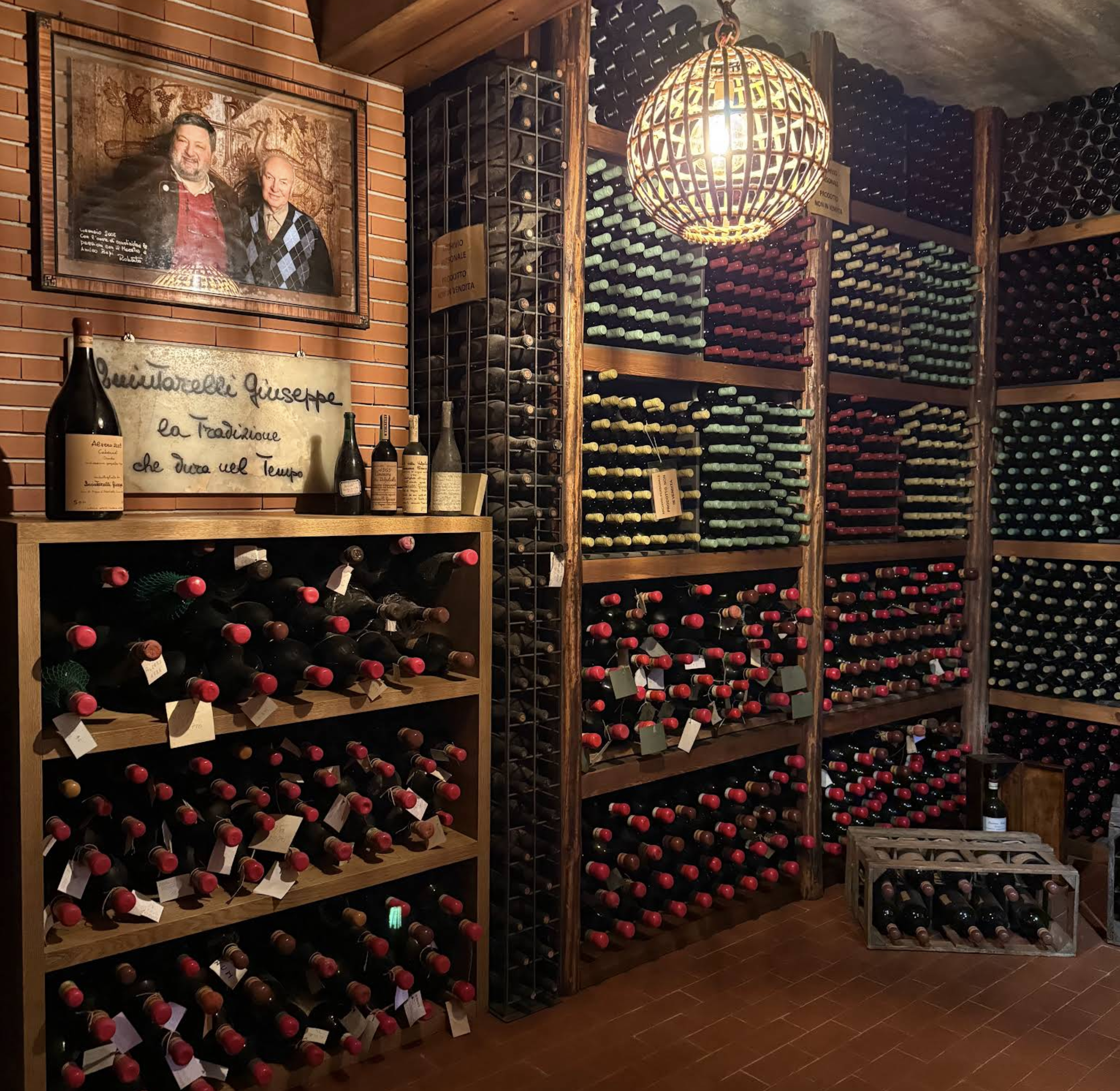
Demo clients: Quintarelli Giuseppe (Valpolicella, IT) · Holmfirth Vineyard (West Yorkshire, UK)

③ Industrial — forward

Industrial estates & infrastructure

Coverage via thermal imaging and photogrammetry — asset inspection, hotspot and leak detection, site mapping. The same fleet, twin and dispatch engine already support thermal and RGB survey; only the anomaly semantics change.

No re-architecture required — the platform is already built for this vertical.

Positioning

Built to extend the expert — never to replace them.

This is not autonomy dressed up as a service. Fleet Command is an instrument in the hands of the turf manager, agronomist or estate operator — the eyes, the reach and the record to run a far larger site at the same standard of care. Every decision that matters stays with the expert.
  • It amplifies the specialist, it doesn't replace them. The fleet shows exactly where to look and does the legwork across terrain no team can cover daily — but what a reading means, and what to do about it, remains a human call.
  • Scale without losing the standard. One specialist can hold a whole golf course or training complex in view, zone by zone across every surface, and act only where it's genuinely needed — so growing the estate never means thinning the attention each area gets.
  • Never a consumer-facing story — the club's or estate's brand is untouched, and the B2B and end-consumer channels stay completely separate — no "powered by" on the scorecard, label, or jersey.
  • Served from regional engineering hubs near the client base, so owned hardware stays maintained and available year-round.
A premium managed landscape
Roadmap

From simulator to autonomous fleet.

Now
Phase 0

Simulator

Full simulation & demonstrator — the dev harness, the demo, the prospect sandbox. Four real venues modelled.

Phase 1

Aerial MVP

Drones with RGB + multispectral; surface-health maps as a service. 5–10 pilot sites — golf & football first.

Phase 2

Ground platform

Rovers for precision treatment and soil sampling; air-to-ground response. Crops vertical opens. First hubs.

Phase 3

Full fleet

Coordinated aerial-ground autonomy, fire suppression, thermal/photogrammetry for industrial estates.

Phase 4

Platform & data

Cross-site benchmarking, early-warning networks, insurer and agronomy partnerships across verticals.

Traction

Traction

Live today: a working simulator and demonstrator (Phase 0) — the same one you just watched run a full site morning end-to-end, across four real-world venues.

EAP prospects engaged: Willow Valley Golf & Country Club (Brighouse, West Yorkshire) and Leeds United FC — Thorp Arch training complex (Wetherby) — both actively scoped for onboarding, and each already modelled in the simulator from its real terrain and playing-surface geometry. Demo clients: Quintarelli Giuseppe (Negrar, Valpolicella) and Holmfirth Vineyard (West Yorkshire) — established vineyard operators demonstrating the crops vertical.

[ To complete ]
  • [ Letters of intent — Willow Valley, Leeds United, pilot sites ]
  • [ Partnerships — turf-science bodies, agronomy, insurance ]
  • [ Hardware prototype status ]
Team

Team

[ To complete ]
  • [ Founders and roles ]
  • [ Key hires — engineering, viticulture, ML ]
  • [ Advisors ]
The ask

The ask

[ To complete ]
  • [ Raise amount and instrument ]
  • [ Use of funds ]
  • [ Milestones this round unlocks — e.g. Phase 1 pilots ]
Autonomous fleet at work
Fleet Command
Terravect Systems

The orchestration layer for autonomous surface management — software-first, hardware optional, and invisible to the brand on the pitch, the fairway or the bottle.

Confidential
01 / 15